|
John L's Old Maps / Supplementary Pages: Photos of the Source of the
|
|
Click on images for extended view in separate window. |
|
Old Map Collection – web version 4.2 (5/24/07): |
A Special Cross-Swamp Expedition
|
|||
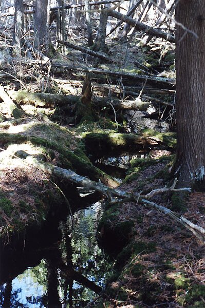
 19 |
 20 |
 21 |
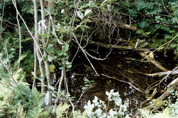
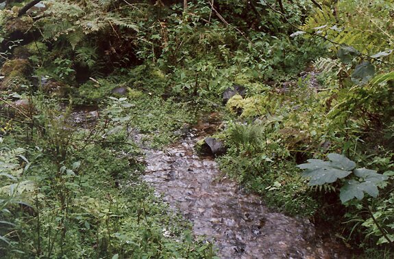
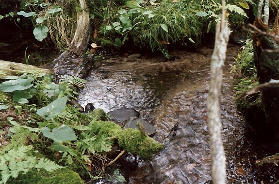
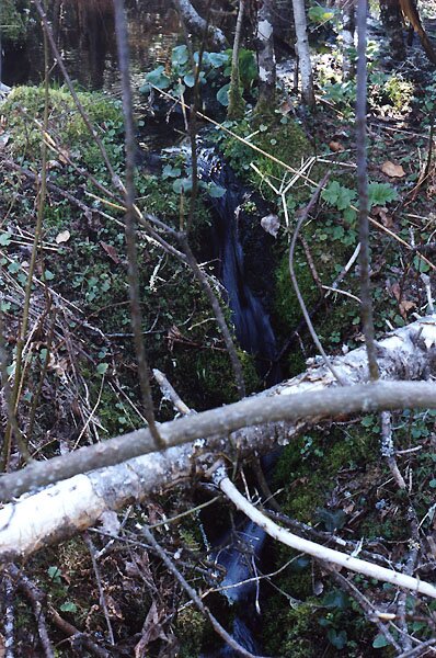
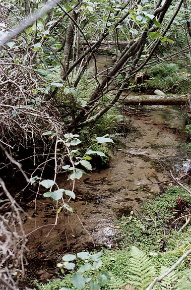
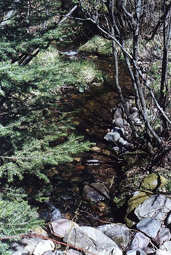
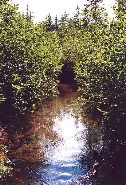
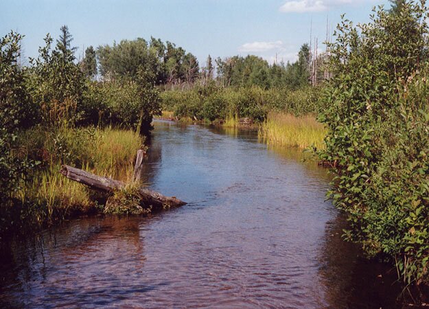
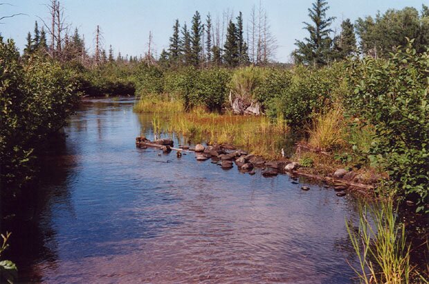
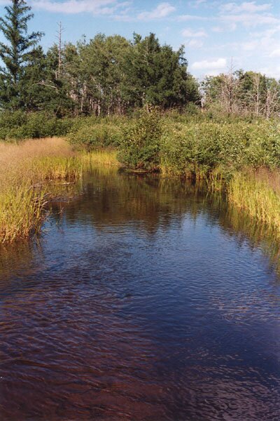
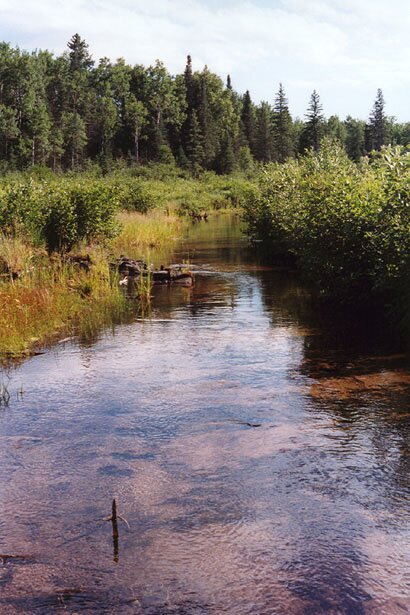
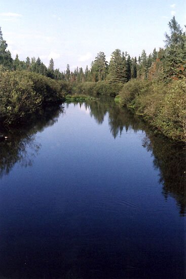
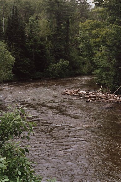
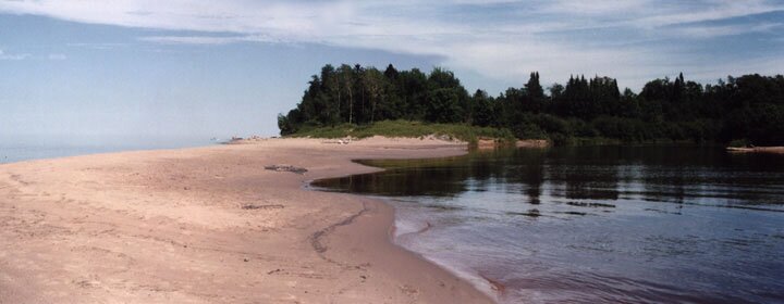
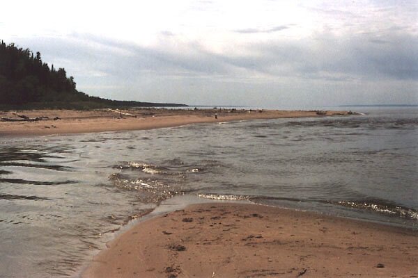
We resume our hike (from the previous page) through the swamp in a northeasterly direction, parallel to the portage trail which is up on high ground to the "right." We see less water in pools or streams beneath the surface, and the swamp appears less saturated. 19 – We come upon this small spring-fed pool at the edge of the swamp just 50 yards from the trail. Springs pour out from the steep banks along the swamp. 20 – The outlet from this pool heads in a northerly direction and after a few yards is joined by another tiny, spring-fed stream. This view is looking upstream; the small pool is just out of the picture to the upper left. 21 – Now it would be a neat thing to think of that small pool as the ultimate source of the Brule River (at least of the East Fork), but such is not the case. Turning around at the point where photo 20 was taken – and taking a few steps downstream – a large branch is seen to pour in from the left. Following this latter branch upstream for awhile in a roughly southwesterly direction, one can see that it has a good claim to be the primary branch of the East Fork of the Brule River. In essentially back-tracking in the direction of the pond, I was hoping I would still be able to find some obvious evidence to connect this stream with the pond's inlet (i.e., what Lt. Allen and others had observed as the pond's eastern outlet years ago), but such was not the case. The stream simply emerged from a small elevated patch of "wet swamp" – probably built up by a process of debris accumulation that a fluvial geomorphologist could best describe! 22 – Here is the first rough water on the East Fork – a noisy little waterfall a few inches wide and about two feet high. 23 through 25 – As one hikes continuously downstream (toward the northeast), one sees the Brule River taking shape and beginning to resemble a real trout stream as branches large and small pour in. 26 – Two miles from the start of the portage trail near Upper St. Croix Lake (and one mile from the pond), the Brule River is navigable to canoeists. In this photo taken in July, 2001, a light-colored wooden post is clearly visible; on its other side is marked "PORTAGE" in vertical letters. The West Branch joins a little farther downstream. 26A through 26E – The swampy area seen in photo 26 became considerably grown up by July, 2005, and the wooden post was difficult to detect among the tall grass. These photos of the portage area from the latter date show the Brule emerging from a clearly non-navigable section of the stream (photo 26A) and then widening near its intersection with the foot trail. (Photos 26A and 26E were taken upstream; the rest downstream.) This part of the Brule is similar to the inlet of the pond discussed and shown on the previous page in a few ways: The water is very cold (a refreshing experience on a hot summer day), there are those hand-size green and orange rocks here and there, and the current flows just as fast although with quite a bit more volume. The reason for the apparently artificial arrangement of log and rocks seen in photo 26C was not evident. 27 – At the "Stone Bridge" (aka "Stone's Bridge") about 4 miles downstream from the portage, the Brule flows slowly on, not reaching any major rapids until about 4 miles farther on. 28 – A view of the Brule 7 miles farther downstream, about 16 miles (as the ravens fly) south of its outlet into Lake Superior. 29 – About three miles from Lake Superior, the Brule looks like this. 30 and 31 – Two views of the mouth of the Brule taken from about the same spot, looking upstream and downstream respectively. A link to a recent aerial photo of this historic place can be found by clicking here. 32 – From the other (western) side, here is another view of the Brule coming in to Lake Superior. |
 22 |
 23 |
 24 |
|
 25 |
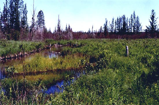 26 |
 26A |
|
 26B |
 26C |
 26D |
|
 26E |
 27 |
 28 |
|
 29 |
 30 |
 31 |
|
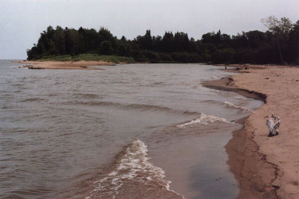 32 |
|||
Go to Part 3 or |
|||
|
The hike on and off the portage trail that is described on these pages is a composite |
||
|
" E-mail me at jlindquist001 @ gmail.com . |
Page last modified on 1/10/15 at 5:45 PM, CST. |
|