|
John L's Old Maps / Supplementary Pages: Photos of the
|
|
|
|
THIS IS THE HOWARD CREEK PAGE. |
||
|
This is the fourth in a series of web pages based on visits to Itasca State Park in Minnesota since August, 2009. Rather than inserting revisions and additions to what I had written originally (as I've done with each visit to the common source of the Brule and St. Croix Rivers), these pages progress almost like chapters or blog installments – adding new photos, videos and insights from each succeeding visit and happily not yet laying bare any grievous errors posted earlier.
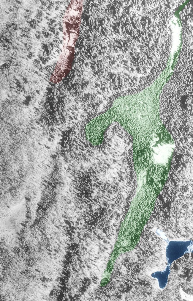
To give some perspective to my very rough sketch map on the right, Whipple Lake is approximately two miles south of Lake Itasca, and the western side of Itasca is approximately three miles from the mouth of Nicollet Creek to the start of the Mississippi. The explorers who wrote about the area took into account the extreme convolutions these streams make as they run their course, so their figures tend to be much higher than what a straight-line measurement on a map would indicate. I do not attempt to be comprehensive in my depiction of important natural features; for example, I only indicate two of the swamps which have been associated with these web pages. The entire area which includes Lake Itasca at its northern extreme and Hernando de Soto Lake near its southern extreme constitutes the real Headwaters of the Mississippi River. Lake Itasca basically serves as a funnel which collects water that flows and seeps from the more southerly lakes, ponds, streams, springs and swamps. Many may "walk across the Mississippi" at the outlet of Lake Itasca, but how many have beheld the very substantial Nicollet Creek which enters into the southwestern end? That is where the fascination begins for, it seems, an ever-dwindling number of students of the nineteenth century explorations by Schoolcraft, Allen, Nicollet, Brower and their associates and followers whose works only begin to be listed here. To reiterate some facts from the previous three pages of this minisite: In the 1830's, the explorer Jean Nicollet considered Whipple Lake as the beginning of the Mississippi River. This lake is fed by springs from the hills, and the outlet flows northward toward Lake Itasca. However, as made known in publications by J. V. Brower (in the 1890s), there is not an open channel over the entire two-mile distance. This is due to a couple places where the water pools up, travels underground and then comes up as springs which re-collect to continue what Nicollet called his "infant Mississippi." These "disconnects" are pointed out on the map with red asterisks, and a video which shows one of them covers the area between the small green dots. What I have labeled as "Upper Nicollet Creek" is not called so officially, and present-day mapmakers conveniently leave it off their charts entirely. Brower found it of enough importance to call it the "Detached Upper Fork of the Mississippi River." Three lakes along the way were noted by Nicollet in his Official Report. As Brower did not think Nicollet had gone all the way to Whipple Lake, he came to his conclusion that the three lakes were those which are labeled U, M and L (for upper, middle and lower) on this map. However, according to the more-recently published Journals, Nicollet most likely had Whipple Lake in mind as his first (upper) lake and "M" (called Nicollet Lake presently) as his third (lower) lake. A summary of his Report and Journals regarding this area is presented here. As for Nicollet's second (middle) lake, I speculate on where that may have been in the discussion below. Also below is a description of my expedition to find Howard Creek whose name was given by Brower in honor of Henry Schoolcraft's daughter, Jane Howard. As noted by Brower (in his 1893 volume referenced here), the head of Howard Creek begins the longest perennial course of open water through the Mississippi River to the Gulf of Mexico, save for the tributaries of the Missouri River. "Perennial" is a key word, as a tributary of Elk Lake begins at about the same latitude but – according to Brower (1893) – it dries up considerably in the summer and can only be considered intermittant. I do not claim that my visit to Howard Creek is unique in any way, as – for one thing – the place is probably crawling with deer hunters in the fall. |
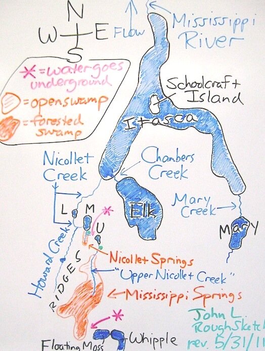
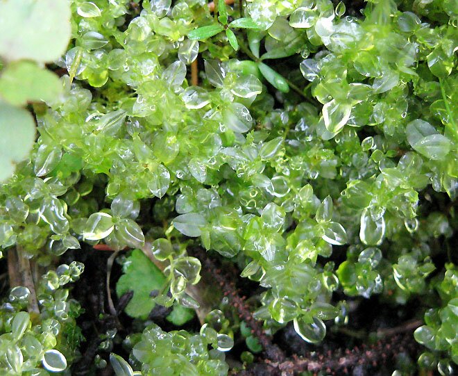
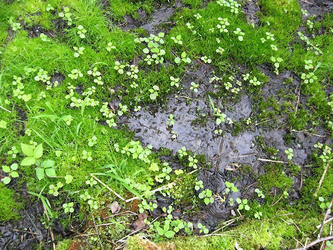
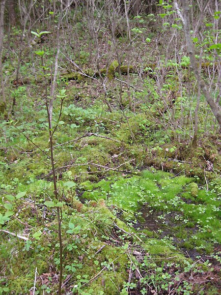
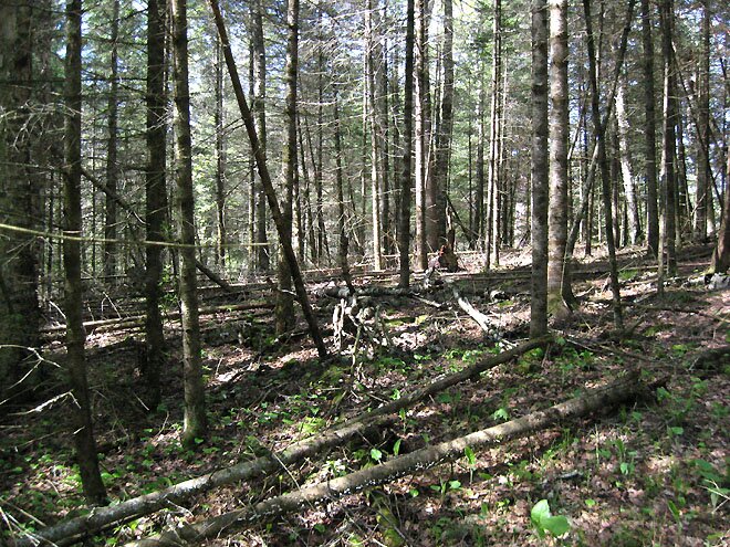
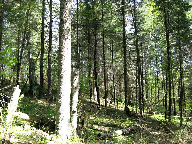
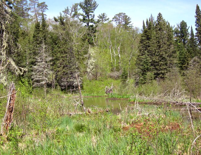
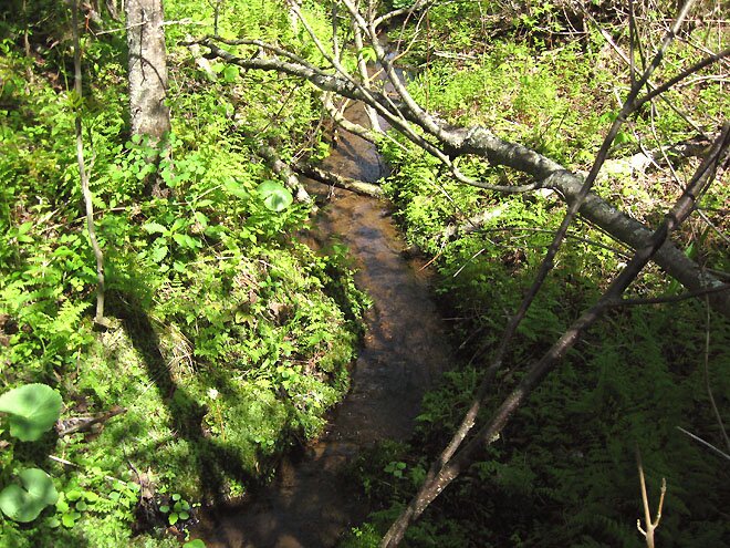
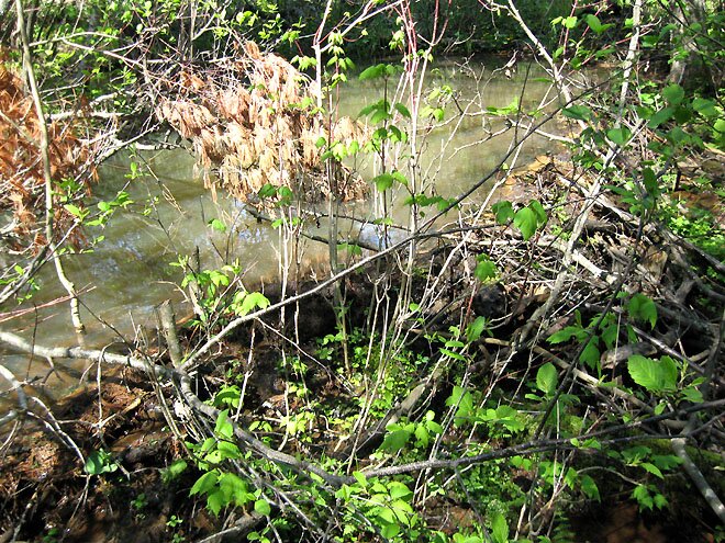
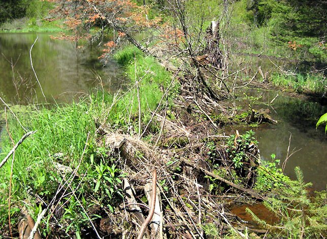
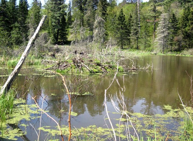
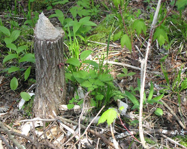
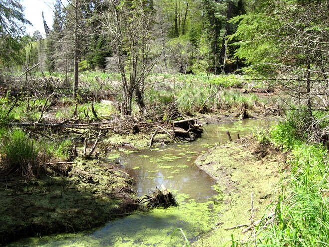
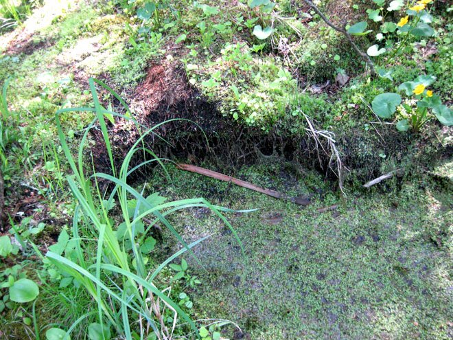
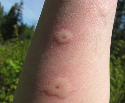
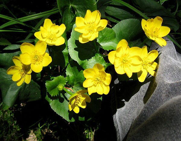
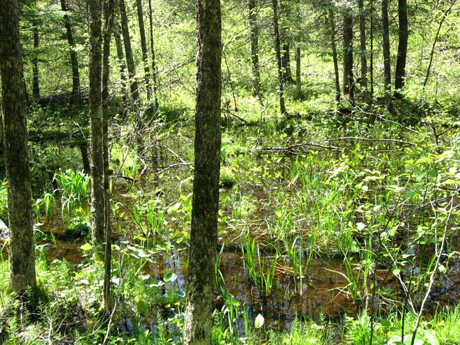
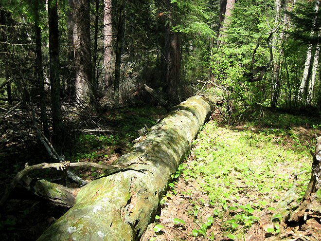
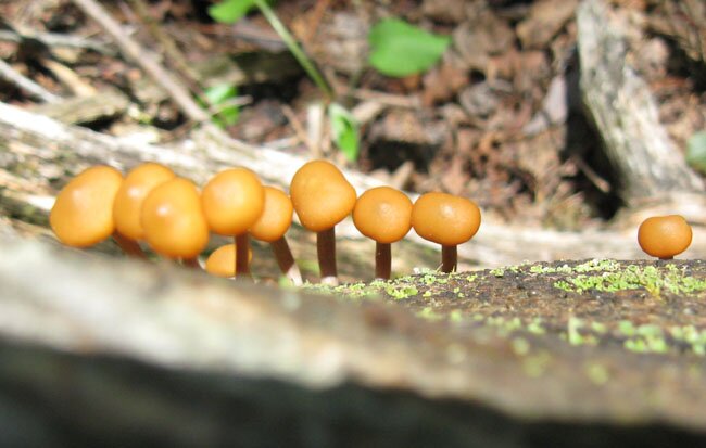
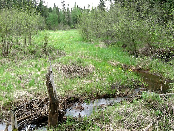
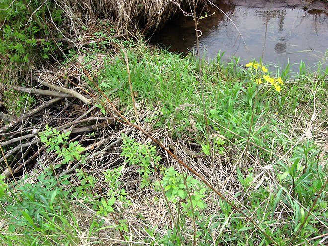
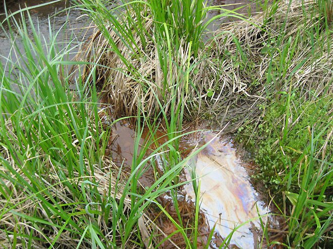
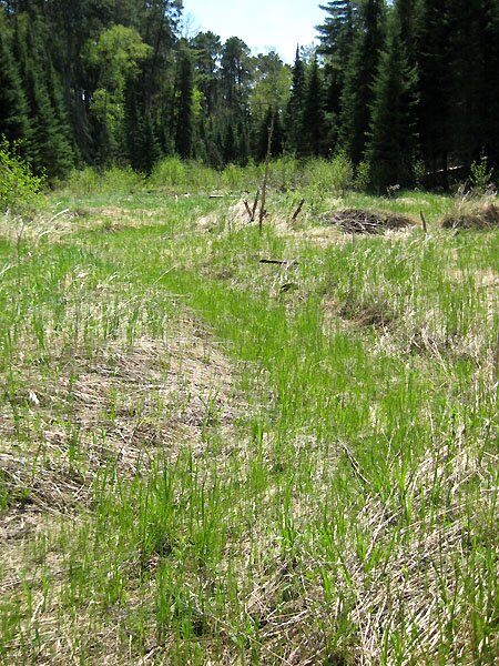
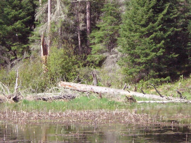
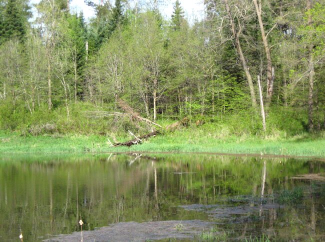
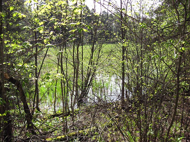
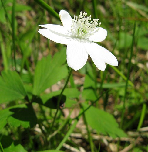
The Hike to and from Howard Creek.Starting from "Upper Nicollet Creek" (UNC) at about the spot where the arrow points to the stream on the map, I headed in a more or less westerly direction, attempting to keep the morning sun on my back as much as possible. (Often my tendency is to drift in a counterclockwise direction and wind up back at my starting point.) A topographical map obtained from Microsoft Research Maps indicated a few ridges to travel up and down on the way to Howard Creek's valley. As I walked from UNC up an incline, the ground appeared quite soggy (Photos 1-2) due to the abundance of springs, and noticeably dry ground finally appeared at the base of the first real hill (Photo 3). As I meandered toward the Howard Creek valley – maneuvering around fallen trees and thick brush – things got a bit greener (Photos 4-5), and the ground felt soggy again, even at the top of a hill. My first, somewhat distant glimpse of Howard Creek was a small pond (Photo 6) which I surmised may have been backed up by a beaver dam. Indeed, a lodge is seen in this photo taken with my cell phone from a different angle. Walking in a southerly direction (i.e., upstream from the aforementioned pond), I found the creek running clear over rocks and sand (Photo 7) and coming out of a multi-tier beaver dam which resembled a series of locks. Above the top dam (Photo 9) was another pond (here and also Photo 10) containing at least one beaver lodge. A cloudy appearance was seen in the pond and also at an intermediate level between dams (Photo 8) – probably indicating (by refraction in shallow water) a muddy substratum. I likened the color to that of a "dirty pea soup" – not the least bit appealing. Brower described Howard Creek in his 1904 volume as a "small picturesque little stream with several miniature waterfalls." In place of waterfalls, I saw these beaver dams. However, I hardly walked along the creek for any real distance. The activity of the beavers was quite evident (Photo 11). A little farther upstream, I noticed small spring-fed streams heading toward the pond (Photo 12), and one in particular (Photo 13) was seen to trickle out of an opening in the hillside. Even though I was repeatedly giving myself a sponge-bath with insect repellant, they got to me anyway, drilling right through my jacket (Photo 14). As much as they liked having me around, I felt a need to bid them and the Howard Creek valley adieu, although an affectionate cluster of marsh marigolds (Photo 15) did its best to delay my departure. Heading back in a roundabout fashion, I came to a "bay" on the western edge of the swamp which encloses the Mississippi Springs (Photo 16). Back to the hills for easier walking, I saw an incredible number of downed trees such as one that lay on the ground over its entire length of well over 100 feet (Photo 17), winding its way through the vegetation like a huge above-ground pipeline. It must have made an incredible noise when it fell. Recycling of the elements was evident as fungi (Photo 18) and undoubtedly bacteria were busy at biodegradation, ultimately releasing nutrients for the sustained continuation of life in this self-perpetuating forest. Revisiting "Upper Nicollet Creek" (UNC) and Clarke and Brower's Theoretical Lakes of Nicollet.As the "Upper Nicollet Creek" rushes away from the Mississippi Springs toward what Brower called the "Upper Lake" of Nicollet (which, as we recall, really wasn't), it passes through a non-forested swamp (Photo 19) southwest of the "Nicollet Cabin," an interesting structure situated just off the Nicollet Trail. That this swamp may have been inundated significantly in years past was evidenced by the presence of old beaver dams (Photo 20). A functioning beaver dam at the downstream edge of the swamp could raise the water level considerably, forming a good-sized pond which may have been the middle (second) lake which Nicollet saw as he made his way north from Whipple Lake to Itasca. A short distance upstream, an iron spring with an oily sheen (Photo 21) trickles into the creek. Downstream – approaching Brower's "Upper Lake" – an old course of UNC is evident among the remains of beaver dams from many years past (Photo 22 and also here). On the west bank of the lake (more like a pond, actually), a large, old red pine which I had seen on my first visit to this area (here, Photo 5) was sadly rendered horizontal (Photo 23). This pond where UNC backs up is enclosed in an oblong depression, and the ridge in the northwest corner which prevents a surface outlet leading directly to the Gulf of Mexico (via Nicollet Creek and Lake Itasca) can be seen in Photo 24. What Clarke (prior to Brower) had thought was the "Upper Lake" of Nicollet (shown in a relatively dry state here, Photo 9) was considerably flooded during the present visit (Photo 25, below). It isn't hard to imagine a past connection with the nearby Nicollet Lake; the only thing presently in the way is the Nicollet Trail which runs atop what appears to be an artificial elevation. Still More Geography.
In the accompanying colorized aerial photo of the area considered above, Howard Creek and its surroundings are tinted red, the swamp enclosing the Mississippi Springs is in green, and Floating Moss Lake (with its wet southwest and dry northwest extensions) is in blue. (Open water and shadows assume a darker color, and perhaps the green shading should be extended a bit laterally.) Some aerial photos and topographical maps suggest a more southward extension of Howard Creek and its valley, but Brower puts the stream's actual origin as indicated herein. (Recall that the streams run from south to north in this area.) Furthermore, in light of my several visits to this area over the past two years, I altered the rough whiteboard sketch at the top of this page to accomodate Clark and Brower's original observations of the relevant streams and lakes; click here for the modified sketch map and also here for a close-up. (All this will probably make more sense to those with these references in hand.) Clarke and Brower's designations are in green lettering, and – left out of the legend – no. "2" of Clarke represents Nicollet Springs. On Clarke's survey map, he placed lakes (or ponds) "F" and "G" close together. "G" is Floating Moss Lake, an originating source of water for the Mississippi Springs which feed the UNC according to Clarke, Brower, and subsequent observers. One would then think Clarke's "F" is the southwest bay of Floating Moss Lake. Later, after making his way upstream what has since become known as Howard Creek, Clarke considered the originating source of water in the springs which feed the creek as the same "F." This would appear to be highly unlikely, and such closeness of the sources of Howard Creek and the UNC is not seen in Brower's maps. (Nor is it today.) Perhaps Clarke saw a water-filled depression in the western "bay" of the swamp enclosing the Mississippi Springs, and determined that to be what he had labeled before as "F." (Just a theory.) Anyway, whatever Clarke may have seen as "F" in any case, I have indicated as such on my rough sketch map. This can perhaps be visualized more clearly on the geographically-correct aerial photo. A PowerPoint presentation of all this may be in order someday, although I am afraid that those really interested in such detail have long since passed on. Winding Down this Visit.
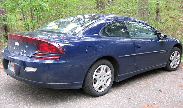
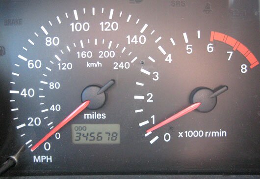
What I initially thought was a wild strawberry flower is probably something very similar. Usually this plant has flowers with five petals in a cup-like arrangement, but I have frequently seen flattened-out 6 and 7-petaled variants (here and also Photo 26). On the way back home on May 26, my trusty vehicle – the 2001 Mitsubishi-built Dodge Stratus Coupe (Photo 27) – hit the magic 345,678 milestone (Photo 28). Finally, it is broken in and good to go for many more visits to historical sites, the likes of which one does not learn about from our state and federal tax-supported institutions but must go off-trail to see and touch first-hand. Microbiology.As is often the case when visiting lakes and streams, I secure a sample for subsequent bacteriological analysis. Finding one or more kinds of purple non-sulfur photosynthetic bacteria (PNSB) is a "given." This type of organism is regularly cultured from water samples in the UW-Madison Microbiology 102 lab course which I teach. They are also easily recovered from rain, snow, icicles and hailstones through the process of enrichment and isolation (click here for an example). On occasion, one may see a "bloom" of these organisms in the water of pitcher plants. In this composite image, we have a three-day-old PNSB enrichment of a Howard Creek sample on the left and the same enrichment bottle at 6 days on the right. This enrichment broth formula (detailed here) is one that is often recommended for the enrichment of PNSB from water samples, but it can be overrun by those green guys (cyanobacteria and algae) on occasion. This time diatoms are the culprit, and a microscopic view is shown here.
A microscopic view of cells from the Chlorella colony is shown here and a subsequent streak plate is seen here. A Google search revealed that simple heterotrophic cultivation of Chlorella has been practiced for decades, so its growth on PCA is apparently no big deal after all. Here is a Nutrient Broth culture that has been on the shaker in the dark for several days. This isolate also grows well on Heart Infusion Agar and Nutrient Agar, and I am now maintaining it on Nutrient Agar slants, kept at room temperature with ambient (office) light. The isolate has been shown to grow throughout the Thioglycollate Medium used in the oxygen relationship test (much more vigorously on the surface), and it also produces acid throughout tubes of Glucose O/F Medium. Of further interest, slower growth with less-intense green pigmentation has resulted upon serial subculturing, done approximately every 6-8 weeks. However, after being kept at room temperature for 8 months and then subcultured into Nutrient Broth and Agar, cells from the original slant cultures grew vigorously, with a dark green color seen on the new slants. Off to the lab for more tests! Maybe we can introduce oxygenic phototrophy to our beginning microbiology lab course through this facultatively phototrophic organism. |
||||||||||||||||||||||||||||||||

|
Continued on |
This page is best viewed at 800X600 or wider. The colorized aerial photo is a composite of images from Microsoft Research Maps (formerly Terraserver-USA) with images courtesy of the USGS. Unless otherwise noted, all photos herein are by myself and were taken on May 24 and 25, 2011. This page was uploaded to the web on 5/28/11 and last modified on 5/15/12 at 11:15, CDT. |