 |
John L's Old Maps / Supplementary Pages: Photos of Old Trains,
|
|
|
|
Communities mentioned on this page are listed here. |
|||
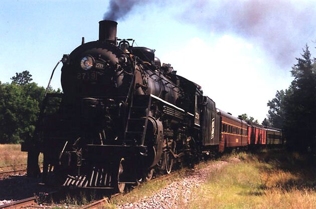
 1 |
 2 |
 3 |
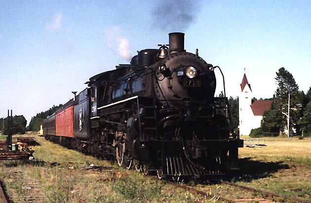
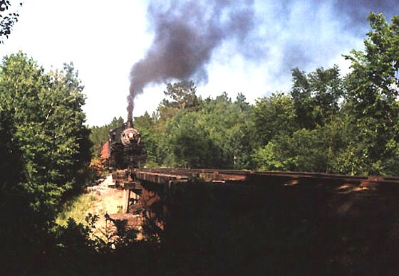
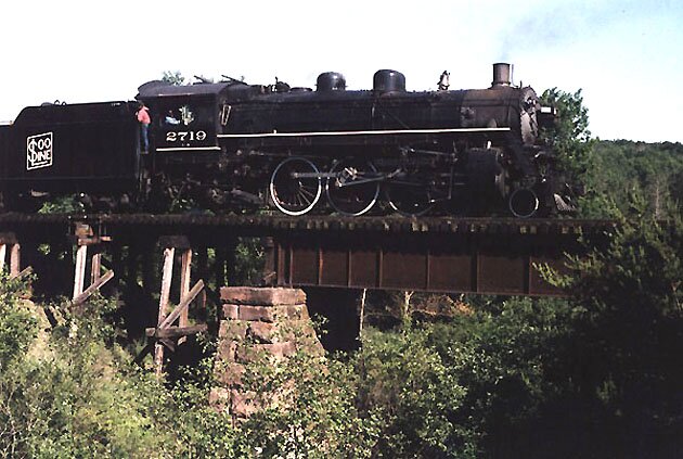
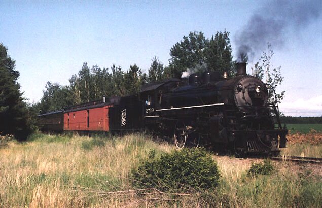
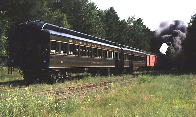
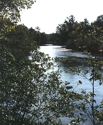
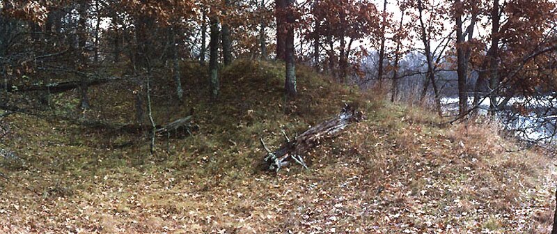
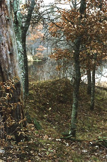
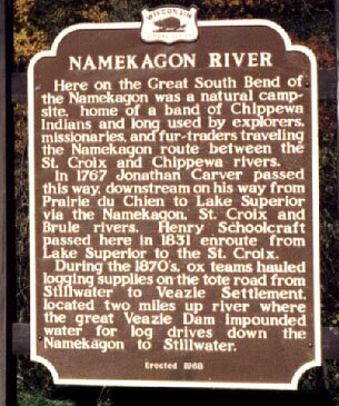
Photos 1-8: Along the old Chicago, St. Paul, Minneapolis and Omaha track (later the Chicago and North Western) between Springbrook and Spooner, Wisconsin. 1 – The Wisconsin Great Northern Railroad operates an extremely popular sightseeing train in the summer and fall on the rail line between Spooner and Springbrook, and a special treat was had in 2002 when the historic steam locomotive 2719 was put to use. In this photo, the train is at Springbrook, ready to begin its southerly trip to Spooner. Update/March, 2015: After several periods of activity and retirement, there are plans to activate Engine 2719 in 2015, as mentioned on its Wikipedia page here. 2 and 3 – Crossing the Bean Brook bridge southwest of Springbrook, near the site of the old community of Ames. 4 – Pulling into Earl. 5 and 6 – Emerging from the woods at Trego Junction and joining the old north-south track which, from the junction, ran north to Superior. 7 – Parked near the Spooner Depot, now the Spooner Railroad Museum. 8 – This old diesel sitting in Spooner has a lot of stories to tell and is probably headed toward restoration. Photos 9-14: Around the Veazie area. 9 and 10 – The area where the Veazie community stood over a century ago (between Trego and Earl) now consists of plowed fields through which the tree-lined railway passes. Photo 9 was shot from the baggage car on a Fall, 2002 excursion pulled by Engine 2719, and Photo 10 is a panoramic view of the site from Veazie Road which runs parallel to the track to the south. 11 – The probable site of the old Veazie Dam is suggested in aerial photos which show a marked constriction in the Namekagon River on what was the old Veazie property. This is an upstream view of the river in the general vicinity of the dam. The aerial photo shown here is a composite made from United States Geological Survey photos found on the Microsoft Research Maps site (formerly Terraserver-USA). Width is approximately 0.4 mile. Flow of Namekagon River is toward the left (west). 12 and 13 – Stretching perpendicularly to the left bank of the river (as one faces upstream) is a rather sharply elevated ridge – looking a bit unnatural compared to the otherwise gently rolling terrain. As it is at the constriction mentioned above, the ridge could be a remnant of the dam built by George Veazie in 1878 which was intended to raise the water level about eight feet such that impounded logs could be floated a considerable distance downstream upon release of the dam. 14 – Historical marker by the river near Trego which mentions the Veazie community and dam and also Schoolcraft's 1831 visit to the native tribes in the area. The latter is summarized in the Mason book cited here which is otherwise devoted to the Schoolcraft Expedition's 1832 "discovery" of the Mississippi River source. A wider view of the scene is here. Move on to Part 2. |
 4 |
 5 |
 6 |
|
 7 |
 8 |
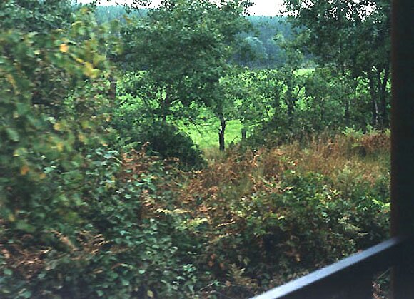 9 |
|
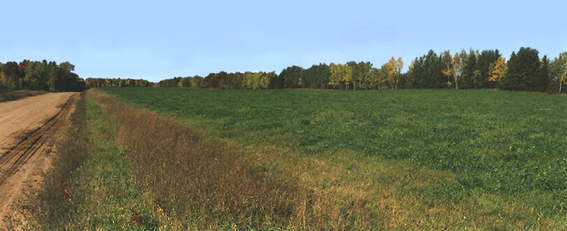 10 |
 11 |
 12 |
|
 13 |
 14 |
||
|
Be sure to visit Veazie.org, |
|||
|
E-mail me at |
Page last modified on 9/21/15 at 4:30 PM, CDT. |