|
John L's Old Maps / Supplementary Pages: Views of the Apostle IslandsPage III: Outer IslandClick on images to see full view in separate |
|
 See the MENU
 |
These photos were taken on May 28, 2009. With a calm lake, sunny sky and cool temperature, a more perfect day could not be had for this expedition to Outer Island which was organized by Ashland historian Don Jaskowiak for the main purpose of examining the remains of the Lullabye Lumber Company camp which flourished in the northeast part of the island in the mid-20th Century. My video which goes along with this web page is presented here. Don has put a number of items on his YouTube channel including slideshows and movies which show activity at the Lullabye camp in the 1950s. An interview with the widow of Ed Bush, logging contractor for the Lullabye Lumber Company, is here. |
|||
 1 |
 2 |
 3 |
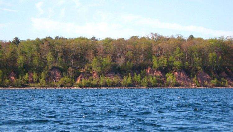
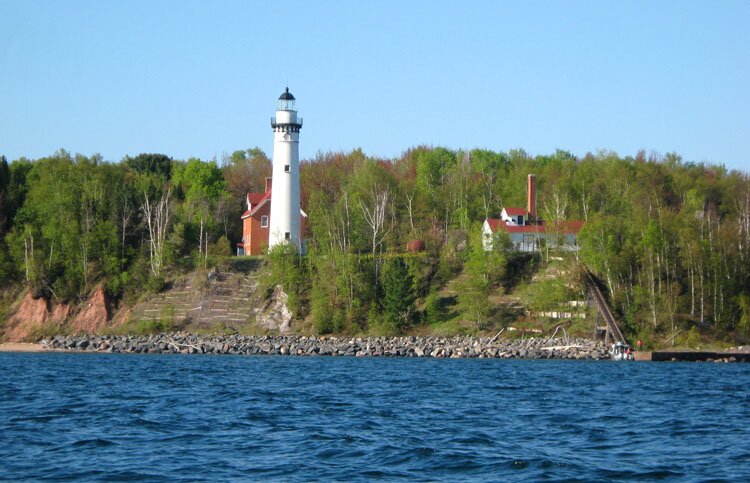
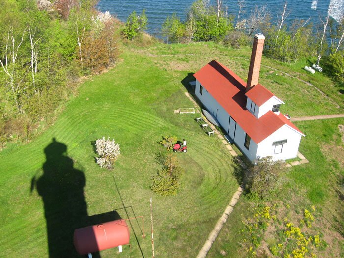
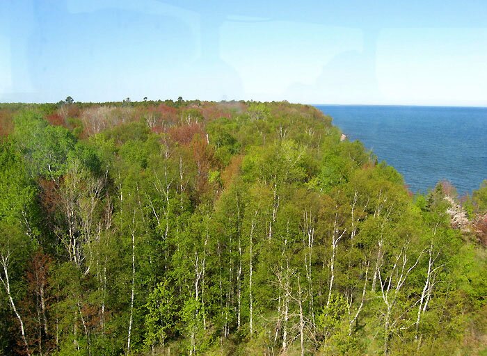
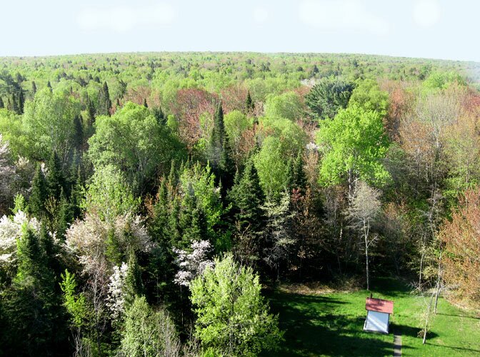
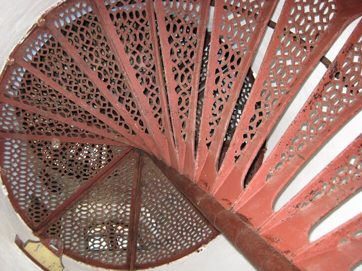
2: A little farther to the east and we come upon the lighthouse. 3-6: Some views from the top of the lighthouse. In Photos 4, 5 and 6, we are looking west, south and north, respectively. The iron ore boat in Photo 6 (taken with telefoto lens) is several miles out, and the shore of Minnesota (approx. 30 miles away) can be seen in the background. 7: Looking from below, this is the staircase to the top which is not exactly friendly to large-size hiking boots. 8: Getting a closer look at the lighthouse exterior. 9: On the trail to the Lullabye camp, we soon come upon a colossal beaver dam. Another view is shown here. The island has its own river system in miniature, and aerial photos (such as the images obtained at Terraserver-USA) show a lot of these streams and dams. 10: For awhile we can turn our backs to the shore and contemplate a whole world in miniature – something, Kellie says, we can always do on islands of any size (and island equivalents such as back yards and tiny offices, for that matter). More views along the path are shown here and here. 11: As we continue our approximately two mile trek to the Lullabye camp, the path gets wider and ditches are seen along the sides, reminiscent of logging roads back home near Hayward. 12-14: The buildings and vehicles are still positioned as they were abandoned half a century ago – a living museum that continues to witness the deteriorating fabrications and the enveloping vegetation. Four more views: X, X, X and X. 15-16: The eastern shore is reached, and here we are looking toward the north to northeast. 17: A view toward the south. 18: A strawberry plant has found a little soil to flourish upon. So far on this day I had seen very few flowering plants on the island except for the gardens near the lighthouse. A few weeks earlier one would have seen acres of flowering trilliums along the path. 19-24: These are some of the shoreline features seen as we cruised southward along the eastern shore. Some of the rock formations almost look like petrified blocks of wood that had been split and squared off with a giant axe. That's right – Paul Bunyan used to hang out in these parts! 25: The actual Paul Bunyans of the Lullabye camp brought their logs from the interior to this ledge from which the logs were dumped into the lake, arranged into rafts, and taken across the water to the mill. It was difficult to visualize the surface from the lake, but the area of this natural platform could be about the size of a football field. A closer view of the edge is shown here. Don Jaskowiak's YouTube slideshow of Outer Island logging photos (click here) shows this platform in use (at 1:45) plus a couple aerial views (from 0:40 to 0:50). 26: Approximately 25 miles away, the Porcupine Mountains on Michigan's shore can be seen in this telefoto view looking toward the southeast. As one visualizes the uneven texture of the lake surface, one might come upon such things as this peculiar view of Gull Island a few miles away. |
 4 |
 5 |
 6 |
|
 7 |
 8 |
 9 |
|
 10 |
 11 |
 12 |
|
 13 |
 14 |
 15 |
|
 16 |
 17 |
 18 |
|
 19 |
 20 |
 21 |
|
 22 |
 23 |
 24 |
|
 25 |
 26 |
||
|
" More Apostle Islands photos: |
This page is best viewed at 800X600 or wider. All photos on these pages are by myself unless noted otherwise. This page was last modified on 1/17/12 at 12:30 PM, CST. John Lindquist: homepage, complete site outline. University of Wisconsin – Madison |
|
|
Spaces inserted into email address to discourage spambots. Please remove before using. |
||